Australia
WA’s Port Hedland, Karratha emergency warnings issued; category 5 storm approaches

Severe Tropical Cyclone Zelia: A High-Stakes Update
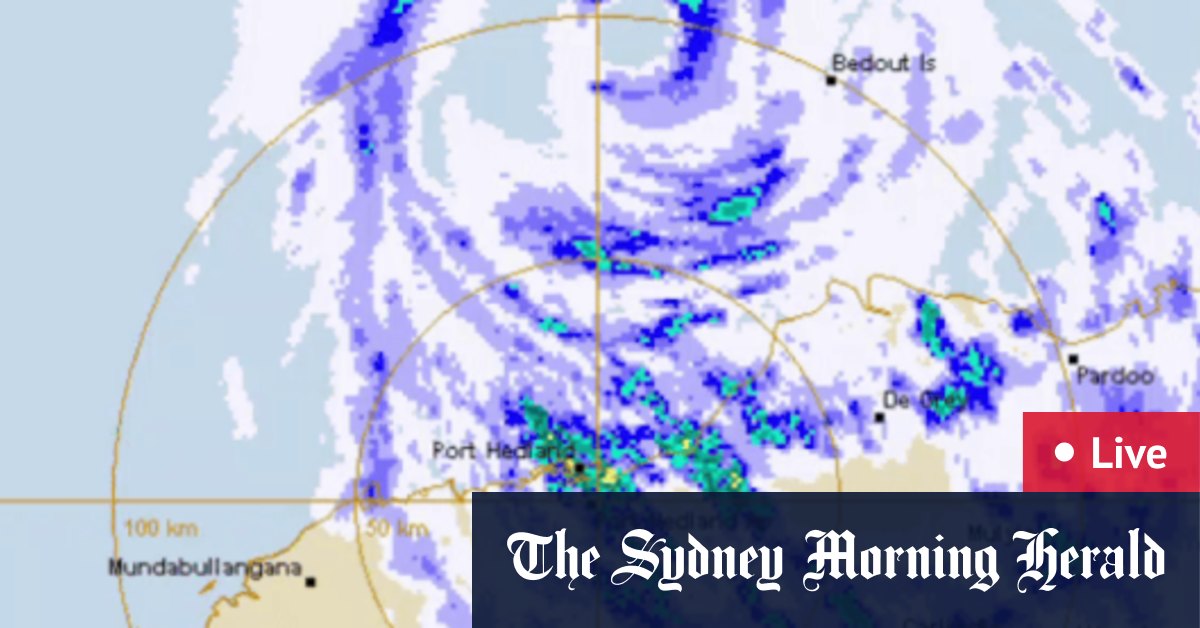
This morning, Angus Hines from the Bureau of Meteorology appeared on Nine’s Today show to provide a critical update on Severe Tropical Cyclone Zelia. The latest forecast reveals significant shifts in both the timing and location of the cyclone’s expected landfall. Initially predicted to make landfall yesterday evening, the updated forecast now suggests that Zelia, a Category 5 cyclone, will cross the coast much earlier—between 2 pm and 4 pm today. This change in timing underscores the unpredictable nature of tropical cyclones and the importance of staying informed as the situation evolves.
A Shift in Location: East of Port Hedland
In addition to the earlier crossing time, the forecast has also shifted geographically. The cyclone is now expected to make landfall east of Port Hedland, with the potential impact zone stretching anywhere from 20 to 50 kilometers east of the town. This region, including Port Hedland and surrounding areas, is bracing for the full force of the cyclone. The slight adjustment in the predicted path highlights the complexity of tracking large weather systems and the need for communities in the region to remain vigilant and prepared.
Heavy Rainfall and Flooding: The Prelude to the Storm
Even as Cyclone Zelia continues to gather strength, the Pilbara coast has already experienced heavy rainfall and flooding over the past couple of days. This prelude to the storm serves as a stark reminder of the cyclone’s power and the challenges it poses. The rainfall is expected to intensify as Zelia makes landfall, exacerbating the flooding and increasing the risk of damage to infrastructure and property. Residents in the affected areas are urged to take all necessary precautions to ensure their safety and the security of their homes.
Wind: The Cyclone’s Most Destructive Force
One of the most concerning aspects of Cyclone Zelia is its wind speed, which could reach nearly 300 km/h. To put this into perspective, winds of this magnitude are capable of uprooting trees, toppling power lines, and causing significant structural damage to buildings and homes. The strongest winds will be concentrated near the point where the cyclone crosses the coast, making the exact location of landfall critical for understanding where the most destructive forces will be unleashed. For those in the direct path of the cyclone, the next few hours will be particularly perilous.
The Importance of Staying Informed
As Cyclone Zelia approaches the coast, it is crucial for residents in the Pilbara region to stay tuned to the latest updates from weather authorities. The Bureau of Meteorology is continuously refining its forecasts, and the situation can change rapidly. By staying informed, individuals can make timely and informed decisions to protect themselves and their loved ones. The cyclone’s unpredictability serves as a reminder of the awe-inspiring power of nature and the importance of preparedness in the face of such events.
A Call to Action: Preparation and Safety
With Cyclone Zelia poised to make landfall, the time to act is now. Residents in the affected areas are encouraged to secure their properties, stock up on essentials, and follow the instructions of local authorities. The combination of powerful winds, heavy rainfall, and flooding creates a dangerous environment that demands caution and vigilance. By prioritizing safety and staying informed, communities can navigate this challenging situation with resilience and unity. As the storm unfolds, the focus remains on ensuring that everyone in the cyclone’s path is prepared to face its fury.


